N4UYB'S   
Hurricane Center


CURRENT ATLANTIC TROPICAL CYCLONE ACTIVITY
The above image courtesy of National Hurricane Center


The Latest on Current
Tropical Storms & Hurricanes


Reload page if images do not appear on the links below.


MENU

Click on any title in menu
below to jump to desired location,
or feel free to scroll down the page.
Tracking MapsRadars & Satellites
GOES 8Other GOES
Evacuation MapsWatches, Warnings, Advisories
Weather UndergroundWeather Cams
Weather RadarsHurricane Names
Hurricane Storm Scales
Shelters in GEORGIA
Frequencies During Hurricane Season
N4UYB's North Georgia Weather


HURRICANE TRACKING CHARTS & MAPS


Current Hurricane Tracking Maps

Click either map below for close up view.


Pacific


Atlantic


Click on any title below for map
Hurricane Tracker Map
Entire Atlantic West Atlantic
East Atlantic Northeast U.S.
Southeast U.S. West Gulf of Mexico
West Carribean East Carribean
Bahamas


THE WEATHER UNDERGROUND

Click on sticker below
for Advisories, Weather Forecasts, etc.


NOTE: If all the stickers don't show up.
Reload page. If this doesn't work,
they are probably being updated.


Click for Miami, Florida Forecast Click for Key West, Florida Forecast


Click for Savannah, Georgia ForecastClick for Myrtle Beach, South Carolina Forecast


Click for Wilmington, North Carolina ForecastClick for Virginia Beach, Virginia Forecast


Weather Watches, Warnings and Advisories


Watches, Warnings and Advisories


Click any title below.

FLORIDAGEORGIANORTH
CAROLINA
SOUTH
CAROLINA
VIRGINIA
Special Wx Special Wx Special Wx Special Wx Special Wx
Public Info Public Info Public Info Public Info Public Info
Watches Watches Watches Watches Watches
Warnings Warnings Warnings Warnings Warnings


HURRICANE EVACUATION MAPS


FLORIDA


Click any county below for map

Broward Florida Keys
Pensacola
N. Miami-Dade Escambia Jacksonville Pasco
S. Miami-Dade Gulfport Hillsborough Pinellas


GA, SC, LA, VA


Click any state below for map

Georgia South Carolina Louisiana Virginia


AL, NC, TX

Click any county below for map
ALABAMANORTH CAROLINATEXAS
Baldwin Coastal N.C. Corpus
Christi
Mobile Coastal N.C. Jefferson
Orange
Chambers


GOES 8


HURRICANE REGION

Click any image below
ATLANTICPACIFICGULF OF MEXICOEAST COAST
IR IR IR IR
Visible Image Visible Image Visible Image Visible Image
Water Vapor Water Vapor Water Vapor Water Vapor


GOES 8


U. S. SECTOR

Color Enhanced


What do you look for in color enhanced imagery?

Usually you look for high clouds or areas with a
large amount of water vapor. In an infrared (IR)
image cold clouds are high clouds, so the colors
typically highlight the colder regions. In a water vapor
image, white areas indicate moisture and dark areas
indicate little or no moisture, so the colors
typically highlight areas with large amounts of moisture.


INFRARED

Click on any image below
EAST CONUSWEST CONUS
Image #1 Image #1
Image #2 Image #2
Image #3 Image #3
Image #4 Image #4


WATER VAPOR

Click on any image below
EAST CONUSWEST CONUS
Image #1 Image #1
Image #2 Image #2
Image #3 Image #3
Image #4 Image #4


Other GOES


GOES 8 East
Satellite Image


GOES 8 Hurricane
Sector IR Image


EARTHWATCH RADARS &
SATELLITE IMAGES


S.E. Radar

U.S. Radar

S.E. Satellite Image

U.S. Satellite Image


WEATHER CAMS


Weather Cams for
FL, GA, SC, NC, VA.


Click Here


WEATHER RADARS


Weather Radars for
FL, GA, SC, NC, VA.


Click Here


ATLANTIC HURRICANE NAMES 1999 - 2015


Hurricane Names

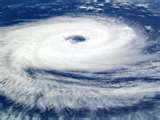
Since 1953, Atlantic tropical storms have been named from lists originated by the National Hurricane Center. They are now maintained and updated by an international committee of the World Meteorological Organization. The original name lists featured only women's names. In 1979, men's names were introduced and they alternate with the women's names. Six lists are used in rotation. Thus, the 2005 list will be used again in 2011. Here is more information about the history of naming hurricanes.

The only time that there is a change in the list is if a storm is so deadly or costly that the future use of its name on a different storm would be inappropriate for reasons of sensitivity. If that occurs, then at an annual meeting by the WMO committee (called primarily to discuss many other issues) the offending name is stricken from the list and another name is selected to replace it.

Several names have been changed since the lists were created. For example, on the 2004 list (which will be used again in 2010), Gaston has replaced Georges and Matthew has replaced Mitch. On the 2006 list, Kirk has replaced Keith. Here is more information about retired hurricane names.

In the event that more than 21 named tropical cyclones occur in the Atlantic basin in a season, additional storms will take names from the Greek alphabet: Alpha, Beta, Gamma, Delta, and so on. If a storm forms in the off-season, it will take the next name in the list based on the current calendar date. For example, if a tropical cyclone formed on December 28th, it would take the name from the previous season's list of names. If a storm formed in February, it would be named from the subsequent season's list of names.


ATLANTIC
HURRICANE NAMES

Hurricane Season runs from
June 1st ~ November 30th
2012
ALBERTOHELENEOSCAR
BERYLISAAC PATTY
CHRISJOYCERAFAEL
DEBBYKIRKSANDY
ERNESTOLESLIETONY
FLORENCEMICHAELVALERIE
GORDONNADINEWILLIAM


Hurricane Names

Click Desired Year Below
1999200020012002
2003 2004 2005 2006
2007 2008 2009 2010
2011 2012 2013 2014
2015 ~ ~ ~ ~ ~ ~ ~ ~ ~


HURRICANE - TROPICAL CYCLONE SCALES


Tropical Cyclone Classification's
(Hurricane Stages)


Tropical
Wave


A low pressure trough moving generally westward with the trade winds.

~ ~ ~

Tropical
Disturbance


An organized area of thunderstorms that usually forms in the tropics. Typically, they maintain their identity for 24 hours and are accompanied by heavy rains and gusty winds.

~ ~ ~

Tropical
Cyclone


A generic term for any organized low pressure that develops over tropical and sometimes sub-tropical waters. Tropical depressions, tropical storms, and hurricanes are all examples of tropical cyclones.

~ ~ ~

Tropical
Depression


An organized system of clouds and thunderstorms with a defined surface circulation and maximum sustained winds* of 38 mph (33 kt**) or less. Tropical depressions are usually numbered in a sequential order as they appear, but it is not until they become tropical storms that they receive an official name.

38 mph or less

Tropical
Storm


An organized system of strong thunderstorms with a defined surface circulation and maximum sustained winds of 39-73 mph (34-63 kt). The system is now given a name.

39-73 mph

Hurricane


An intense tropical weather system of strong thunderstorms with a well-defined surface circulation and maximum sustained winds of 74 mph (64 kt) or higher. Hurricanes are categorized according to the strength of their winds using the Saffir-Simpson Hurricane Scale.

74+ mph


The Saffir-Simpson Hurricane Scale


Robert Simpson
(Born: 1912)

Herbert Saffir
(1917-2007)


This scale was developed in the early 1970's by Herbert Saffir, a consulting engineer in Coral Gables, Florida, and Dr. Robert Simpson, then director of the National Hurricane Center. The scale is based primarily on wind speeds and includes estimates of barometric pressure and storm surge associated with each of the five categories. It is used to give an estimate of the potential property damage and flooding expected along the coast from a hurricane landfall.


Saffir-Simpson Hurricane Scale

CATEGORYWINDSDAMAGE
74-95
mph

Minimal

No real damage to building structures. Damage primarily to buildings, unanchored mobile homes, shrubbery, and trees. Also, some coastal road flooding and minor pier damage.

Storm Surge: 4-5 feet


96-110
mph

Moderate

Some roofing material, door, and window damage to buildings. Considerable damage to vegetation, mobile home, and piers. Coastal and low-lying escape routes flood 2-4 hours before arrival of center. Small craft in unprotected anchorages break moorings.

Storm Surge: 6-8 feet


111-130
mph

Extensive

Some structural damage to small residences and utility buildings with a minor amount of curtainwall failures. Mobile homes are destroyed. Flooding near the coast destroys smaller structures with larger structures damaged by floating debris. Terrain continuously lower than 5 feet ASL may be flooded inland 8 miles or more.

Storm Surge: 9-12 feet


131-155
mph

Extreme


More extensive curtainwall failures with some complete roof structure on small residences. Major erosion of beach areas. Major damage to lower floors of structures near the shore. Terrain continuously lower than 10 feet ASL may be flooded requiring massive evacuation of residential areas inland as far as 6 miles.

Storm Surge: 13-18 feet


greater
than
155 mph

Catastrophic

Complete roof failure on many residences and industrial buildings. Some complete building failures with small utility buildings blown over or away. Major damage to lower floors of all structures located less than 15 feet ASL and within 500 yards of the shoreline. Massive evacuation of residential areas on low ground within 5 to 10 miles of the shoreline may be required.

Storm Surge: more than 18 feet


N4UYB
Click on banner below to visit N4UYB's North Georgia Weather
N4UYB's North Georgia Weather is unavailable at this time.


Created: February 02, 2011